Last Updated on June 10, 2020 by Christine Kaaloa
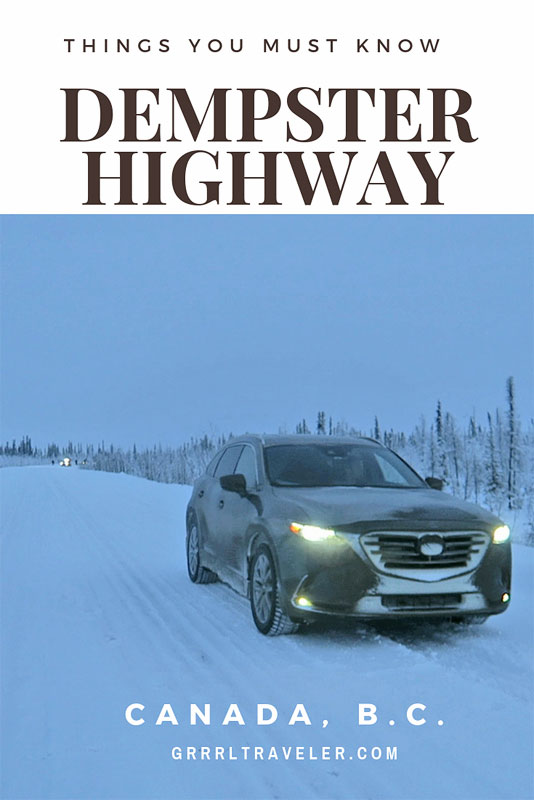
Constructed in 2017, traveling Dempster Highway is a 734 kilometer all-weather road between Dawson City and it further connects Inuvik to Tuktoyaktuk via an all-year road. It is the first road to connect Canada to the Arctic Ocean. Here’s 16 things to know before traveling Dempster Highway.
Alternatively, referred to as the Northwest Territories Highway 8 and Yukon Highway 5, the highway is also the new lifeline connecting Arctic communities such as Inuvik and Tuktoyaktuk, offering the locals better access to better resources and potentially new employment. The highway still presents a long, remote and challenging 16 hour journey for those who undertake it.
Starting from the Klondike Highway outside of Dawson City, it travels up to the McKenzie Delta and the Northwestern Territories. We were traveling Dempster Highway during a wintery December. Riddled with snow and blizzard conditions, the challenge of traveling the Dempster had slightly different challenges than traveling it during other seasons. We started from Dawson City with our final goal being Tuktoyaktuk.
Table of Contents: 16 Things to Know BEFORE Traveling Dempster Highway
- 1 16 Things to Know before traveling Dempster Highway
- 1.1 1. Dempster Highway is an all-weather road of gravel and shale.
- 1.2 2. Take a spare tire and know how to change it
- 1.3 3. Do not take your new car
- 1.4 4. Loose Rocks and your windshield
- 1.5 5. Drive slow
- 1.6 6. Consider stretching your road trip over a couple of days
- 1.7 7. Driving conditions on the Dempster Highway during the winter
- 1.8 8. Create distance between you and the car in front of you
- 1.9 9. Bring enough food and water (and snacks)
- 1.10 10. There is no cellphone signal. Get a satellite phone if you want to stay connected
- 1.11 11. Fuel up before you go (and take an extra gas can, just in case!)
- 1.12 12. The Dempster is a home to a lot of wildlife
- 1.13 13. The Arctic Circle (Latitude 66 33 degrees North)
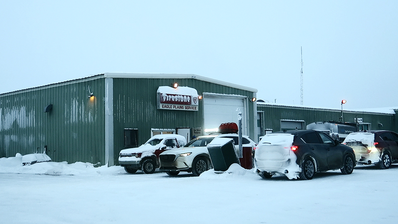
- 1.14 14. Eagle Plains is your half-way mark for gas, car servicing and resources
- 1.15 15. The highway crosses two rivers: McKenzie River and Peel River
- 1.16 16. It crosses the Continental Divide and time zones change by an hour
16 Things to Know before traveling Dempster Highway
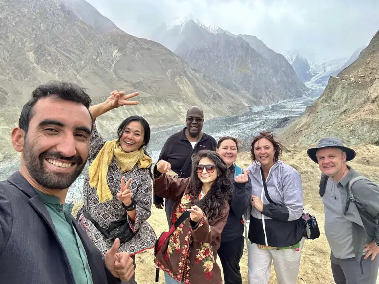
Note: I drove this as part of a Mazda road trip to the Arctic Ocean during early December. We were a caravan of ten cars of influencer, car journalists and we had expedition drivers accompanying us to ensure our safety. Extra provisions and communication backup was brought and thought of in the case of any roadside emergencies.
Apologies for any typos, as these are just some rough notes I wanted to share:
1. Dempster Highway is an all-weather road of gravel and shale.
Dempster Highway is a notorious for being problematic for driving, because it is not paved but made of shale. This is because the roads rest on permafrost and that can melt and shift in some spots. Thus, much of the road is unpaved. It is very possible you may encounter problems with your tires. I’ve read many stories about flat tires.
2. Take a spare tire and know how to change it
Given what i’ve shared about the road and its resources, taking a spare tire and knowing how to change it is essential. As the highway is made of loose shale, puncturing a tire is a probability and It can take a while before you get help. Depending upon how far you are from Eagle Plains, you would need to travel a ways to get a new tire, so it is best to just stock a spare in advance. Know how to change it also as you won’t find AAA help out there. If you get a flat, you may be waiting a while before help comes along.
3. Do not take your new car
I have heard of travelers buying a used car to make the journey or renting a car. I would imagine car rentals for this journey to cost more than standard rental prices given the wear and tear a car will experience on this highway. Mazda brought new cars which were already getting thrashed on the first day leaving Fort St. John on paved and partially iced roads- mud sludge and windshield dings from loose flying rocks. Ironically, the night before we hit the Dempster, there was a snow blizzard, so the roads were powdery. This saved our tires and windshields from standard wear and tear, however, alternately we did have two cars skid off the road and get stuck in snow banks. Luckily we had a team to pull those cars out.
4. Loose Rocks and your windshield
To continue where I left off… otherwise, expect loose rocks to hit your windshield.
It’s best to drive slow on the Dempster, especially when you’re coming up on oncoming cars or large trucks. Each of the ten expedition vehicles we took on this trip, got a fair share of dings just from regular roads (some looked like bullet hole-sized dents!) . This created eventual dings which over time would only grow into cracks in the windshields. If you collect enough of them, you could be looking at replacing your windshield at the end of the trip.
5. Drive slow
The speed limit on the Dempster is 90km/hour. I would not drive that fast given the conditions. If not for the gravel, snow (if you’re driving during winter) or loose gravel biting your windshield, I’d say go slow and take your time if you want your car to be in decent condition at the end.
6. Consider stretching your road trip over a couple of days
We had a tight timeline so we pressed on through the driving, but otherwise, the Dempster can be a place to enjoy. During warmer times there’s scenic beauty and you’ll probably want to enjoy the landscape rather than rush through it. The Dempster Highway website recommends stretching your road trip out to a two day trip vs one. Here is a possible itinerary.
7. Driving conditions on the Dempster Highway during the winter
Winter can offer potentially easier or harder conditions for travel, depending upon your resources and number of travelers. We drove the Dempster Highway during winter and were assured that the road conditions and snow probably helped the tires a bit despite creating potentially slippery conditions, open to skidding.
If you asked our expedition drivers, they said the winter conditions made for easier driving, as the roads are covered in snow; thus, not as much loose gravel to potentially harm tires or hit windshields. Cons are that roads may be slippery and tricky due to snow and ice. If you skid, you may land in a deep snow bank and it would take considerable time for someone to find you to pull you out. Also, due to occasional blizzard conditions, the government may close roads close and you can get held up at Dawson City or Eagle Plains ( your more expensive option – there is a hotel but it is an outpost with limited resources).
However, if you ever got stuck on the side of the road with a dead battery or something, winter is the last time of the year I’d want to be waiting for help to come by.

8. Create distance between you and the car in front of you
Although it’s highly unlikely you’ll find many folks out on the Dempster, if you ever did find yourself tailgating another car, pull off and give them space. If in winter, the snow kicks up and creates a dust cloud which impedes visibility- day and night. Even if it’s not wintery conditions, there’s loose gravel kicking up… remember?
9. Bring enough food and water (and snacks)
Driving the Dempster Highway is approximately a 16 hour journey, with the half point mark being Eagle Plains. Bring enough food and water to tide you over. Although, have reserves in the case anything happens to your car and you need to wait for roadside help.
10. There is no cellphone signal. Get a satellite phone if you want to stay connected
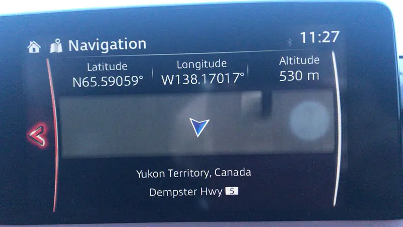
You will not have a cellphone signal on the Dempster Highway so if you encounter any car problems, you cannot call for emergency help. Getting a satellite phone as a backup connection to emergency or city numbers is your only solution. Also, if you want to listen to music for your drive, be sure to download your favorite road trip music playlist for the drive. Our cars had satellite reception so we had music from satellite radio stations and we had a GPS (those are handy!)
11. Fuel up before you go (and take an extra gas can, just in case!)
Once you are on the highway, your next and last service station is at Eagle Plains, the half-way mark of the Dempster . Start on a full tank and take an extra gas can for emergencies.
12. The Dempster is a home to a lot of wildlife
Apparently during warmer seasons, some folks will supposedly camp or hike along the Dempster. The Dempster is home to wildlife like caribou, moose, grizzly and black bears, foxes. Research how to handle wildlife encounters in this area in order to keep safe and please be responsible and do not feed or antagonize the roadside wildlife. Read about Bear encounters. Also for tourist information in this area or the Northwestern Territories, check out the tourism board website.
13. The Arctic Circle (Latitude 66 33 degrees North)
Traveling along the Dempster Highway, you will cross the Arctic Circle and if you stop over you can take a photo with the sign. There is almost nothing around it but it’s still a goal.
14. Eagle Plains is your half-way mark for gas, car servicing and resources
Once you are on the highway, the half way mark and last service station is Eagle Plains, at a high elevation of 2,360 ft, it rests between the Ogilvie and Richardson Mountains . There is a service station (road service, truck towing, fuel, etc..), hotel (ph: (867) 993-2453, http://eagleplainshotel.ca/ ), showers, laundry and rest stop there. During winter, they act as a safety guardian to the highway. If a snowstorm is predicted, they will close the gate to the highway and you will be forced to stay until the highway opens again. Map here: https://www.yukoninfo.com/region/eagle-plains/# Keep in mind, this is an outpost and not a city or town, so it has basic necessities to complete your journey.
15. The highway crosses two rivers: McKenzie River and Peel River
The highway crosses to major rivers- the McKenzie and Peel Rivers and this may entail anything from a ferry crossing or ice river crossing. During non-winter months, cars must use a ferry boat crossing. During winter, the rivers freeze over, creating a bridge crossing. The territory puts up signs when the river ice passes safety standards and is thick enough for cars to pass over it.
Technically, a lake has to be at least 8 inches deep to support an automobile. As ice roads are a commonplace road way to this territory, regulations will be according to safety standards.
16. It crosses the Continental Divide and time zones change by an hour
The constant changing back and forth of clocks threw me off. Not having mobile data plan in Canada, I could only update my time/zone clock with the hotel wifi and between my mobile phone, laptop and FitBit, I often had different times. If time is important to you, schedule a hotel wakeup call and make sure your room clock is working.
For example, from Vancouver:
Fort St. John +1 hour
Dawson City -1 hour
Inuvik +1 hour
You need to cross two rivers- the Peel and Mc Kenzie River before getting to Inuvik. Aside from winter, there are free ferries for crossing the rivers. During winter, they freeze over. Check the signs to see if they are safe for crossing. There will be a sign.
Recommend more things to know before traveling Dempster Highway. Leave comments below.
Watch the full Arctic journey series: Fort St John to Tuktoyaktuk